
Airships: Part 4 - In the air
- Jun 15, 2019
- 10 min read
By Andy Cooke

Airships are great for adding colour to your alternate history, and for showcasing that it is different from OTL.
But unless they're just wallpaper, with a throway comment or two about them, you'll need to know a bit more about what it's like to fly them. About what the people on board (crew and passengers) perceive and have on their mind. You'll also need to know specifics about what can be done with them - how long does it take them to get from A to B? When can they (or can't they) go there? What could go wrong? What does it feel like for them?

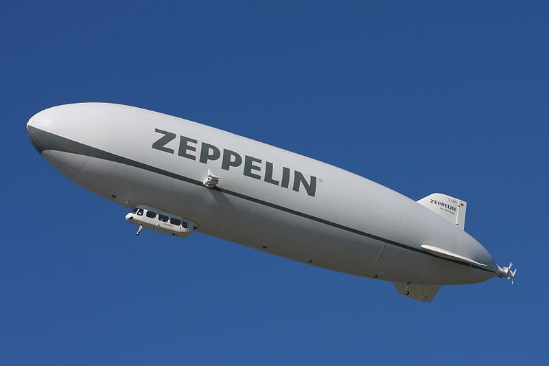
Unfortunately, there aren't many airship captains to ask, or airship passengers. Although the Zeppelin NT looks very interesting, the number of people who have been in one (let alone piloted one) is extremely small. This doesn't mean, however, that it's impossible for us. (Blimps are also still around and much of this applies to them, albeit they are more vulnerable to weather and easy to damage than a semi-rigid or rigid airship).
How the airship handles is crucial for such things as what the airship can do and where it can go, how things go on board (and elsewhere) during the journey, and what the airship captain and crew prioritise and what actions they carry out. This may be obvious, but it's too easy to skip over it; we have our own preconceptions deep within us, based on how heavier-than-air aircraft manouevre.
An airship captain will be sailing on the air, with its currents and thermal waves. More than that, he will be going through the air on which he's sailing, completely immersed.
Two key elements to remember are:
Airships are considerably slower and less manouevrable than (most) other aircraft.
Airships are the same density as the air around them
The second of those statements seems obvious and all-but irrelevant. Until you consider the fact that an airship will always be at the same altitude as the air of the same average density as the airship.
It's as simple as that. If the captain pulls back the yoke or pushes it forward to pitch the airship up or down, it will follow the route pointed (up or down at an angle), but the pressure of the air around it will cause it to bob back to the appropriate altitude. The only way to change altitude is to change the pressure differential.
This can be done in two ways: change the internal pressure (lower means it will rise; higher means it will descend; if the pressure change is large, it will overshoot and bob back down/up a bit. This may be inconvenient, especially when landing) or fly to somewhere with a different outside air pressure.
The latter is something that most people initially overlook. Air pressure at sea level varies as you go through depressions and anticyclones. While your airship is unlikely to be airborne in the centre of a tropical cyclone (air pressure as low as 870 millibars) or reach the sort of pressures measured in a Siberian High (1080 millibars or more), a variance even in the UK between 970 millibars and 1040 millibars is not unusual or noteworthy.

The above image was taken from the UK Met Office General Aviation briefing page on Wednesday 12th June (literally a random choice; I just happened to be typing this at the time). If an airship were to fly from Leuchars to Reykjavik, it would take off, at near sea level, at 1020 mb, and arrive at 1042 mb.
A difference of 22 mb equates to an altitude difference of 660 feet. Crossing the Highlands of Scotland alone, it would cross nearly 10 millibars - if it were cloudy (which it was at the time of this image), that equates to the airship changing altitude by 300 feet (the rule of thumb is 30 feet per millibar). If you are flying in from the north-east and over the Grampians, your airship will descend 300 feet off its own volition. This could, if you are not anticipating it and if you're flying at a comparatively low level, spoil your entire day. Flying the other way, and you would climb 300 feet without knowing it, possibly straying into controlled airspace.
(The altimeter will also become inaccurate to the tune of 30 feet per millibar, but the fact that the aircraft itself follows the increasingly inaccurate altimeter reinforces the problem).
Captain Ellison stared at the chart. It was no good. It didn't matter how long he looked at it, no more information was there. He was just going to have to make the journey without reliable Air Met. From Leuchars to Reykjavik, across the Highlands of Scotland and out over the North Atlantic.
Kerwin was at the helm as His Majesty's Airship George Mallory rose into the sky; Ellison didn't need to be watching over his shoulder. The young cadet - recent ex-cadet, actually - could probably do with a show of confidence in him from his Commanding Officer, so Ellison nodded, said, "Carry on, Mr Kerwin. Up to four thousand on QFE before switching to QNH, then make your own judgement on the smoothness of the ride. If you need to rise over the inversion layer, it's at about six or seven thousand today, but remember that the heavy boys have an airway up at FL80."
"Aye aye, sir," said the youngster, his face taut with concentration. The HMA George Mallory was certainly the largest vessel he'd ever have piloted. Six hundred feet from stem to stern, a hundred feet in diameter - yet surprisingly responsive. Ellison paused for a moment, swapped a meaningful glance with his second-in-command, Molesworth, and left the control cabin. He'd seen enough to be comfortable; Kerwin had chosen to climb at about five hundred feet per minute; cautious enough to minimse the risk of overshoot but rapid enough to get to altitude fairly quickly. And, of course, Molesworth was totally reliable; he'd keep an eye on the boy.
The above brief scene has too much specialist information for most audiences. Professional aviators would be fine with it; most people, not so much. It is, however, what a putative airship captain would be doing and thinking in this scenario
A competent airship commander (or pilot, or navigator) will therefore always have meteorological maps as up-to-date as possible. When flying where no such charts are available, he or she will be as cautious as a sea captain who has no maritime charts of the seas he or she is sailing - and for similar reasons.
Just to confuse matters, there are three separate height measures referred to: QNH, QFE, and FL. All of which differ significantly.

QFE is the height above the ground at the airfield. The letters after the "Q" are theoretically meaningless, but pilots remember them as "Field Elevation". When your altimeter reads zero on QFE, you are on the ground. Aviators will call this "height."
QNH is your altitude above sea level. When your altimeter is set to the pressure given in the map above at that location, it will read your altitude. This will be, in virtually every case (other than at the Dead Sea, I suppose), higher than your QFE. Knowing the pressure setting for QNH at that location is critical for finding out your true altitude. Again, the letters were after the "Q" were randomly assigned, but aviators remember them as "Naval Height"
FL is Flight Level. Many people will know that this is measured in hundreds of feet, so FL80 is 8,000 feet above mean sea level. Fewer people know that this is measured against a constant nominal QNH pressure: 1013.25 millibars. This is also known as QNE.

The implication of this is that the real-life altitude above sea level of any given Flight Level changes with the weather. In the example, at Leuchars (1020mb), FL80 would be up at a QNH altitude of 8,210 feet, and as you left Scotland to the Northern Atlantic in the North West (1028mb), it would be 8,450 feet (So young Kerwin actually has plenty of height to play with above the inversion layer - albeit neither of them know this without accurate Air Meteorology information (Air Met)
Ellison headed towards the radio room. As the airship gained height, he'd gain range on the radio and possibly get into contact with Kinloss. The ground radio at Leuchars might be broken, but surely Kinloss - or Lossiemouth at least - would be on the air? He needed at least an up-to-date METAR; the estimating he was doing from Leuchars' TAF was far too uncertain. Fifteen knots from 240, so maybe 25-30 knots from 270 at altitude? That was what he'd used for his provisional navigation, anyway. He absolutely had to know the QNH across his route, though; it would be too easy to stray unknowingly into the controlled airspace.
He continued down the keel corridor, balanced against the gentle slope from the climb with practiced ease. Ellison paused for a moment as the airship shuddered - low-level turbulence in the thermic air. He hated taking off in the early afternoon in summer. Another shake. That would be enough for Kerwin to take the hint he'd given him, surely? He'd keep climbing to six thousand feet into...
"Ah, Captain!"
Ellison closed his eyes for a moment before answering, his expression professionally smooth. "Lady Walton. What can I do for you, ma'am?"
Lots to unpack there; there's no way you'd be throwing that much at a reader. A METAR is a Meteorological Air Report, and is typically issued regionally and updated every few hours. It contains a summary of wind direction/speed, visibility, pressure setting for QNH, cloud cover, and significant weather in that region. A TAF is a Terminal Aerodrome Forecast, is targeted to the immediate area of the airfield in question, and is far more detailed. Both use lots of codes to compress the information; reading them is an art form (I won't go into detail here; ask in the comments if you really want more!)
Wind speed and direction change with altitude, and usually quite predictably. As the ground acts as a drag on the moving air, it's usually a bit slower low down (you reach the "true" windspeed at about 2000 feet).
Direction-wise, it's less intuitive. The air moving freely at altitude usually swirls around a depression (or high), like water going down a plughole. As a rule, it is moving more-or-less at right angles to the centre of the depression/high. This is called geostrophic wind.
Friction with the ground reduces the geostrophic effect such that the wind can blow more inwards to a depression/outwards from a high. Over ground, it changes the direction by about 30 degrees towards the depression/away from the high (over water, with less friction, the direction change is about 10 degrees).

That's less important for the author, though, than travel through thermic air and the inversion layer. Thermic air is, simply, air with a lot of thermal activity going on. Bear in mind that the Sun doesn't really heat the air directly; it heats the ground, which heats the air above it, which rises in a column. Any type of ground that gets hotter than usual (concrete areas, for example, or any areas with a lot of metal) will have chunky thermals off of it, especially in the middle of the day. If there's not much wind, it's likely to be worse (the air isn't being mixed up). And, for some reason, if there's an easterly wind (in the British Isles).
You're most prone to thermic air when low down, flying slowly, and if you have a large surface area, especially if you're not very dense. (Hello, airships!). And, of course,as airships are physically large in comparison to the columns of rising air, they can have a significant lift on one part of the envelope and downdraft on another part - to the tune of a hundreds of feet per minute. As well as disturbing the airship's path and requiring poor Kerwin to adjust when blown off course too severely, it can stress the body of the airship. This shouldn't be too much of a risk unless the wind shear gets very great - such as around thunderstorms.

HMA George Mallory will not be flying anywhere near a thunderstorm if Captain Ellison has any say in the matter.
Most of the scientific staff he was carrying to Rejkyavik did what they were told, especially on take-off and landing. Lady Walton, their sponsor, was less tractable. She'd remained sat in the passenger quarters on the climb-out on their familiarisation leg from Croydon to Leuchars yesterday; it had been too much for him to expect she'd comply again today.
She wobbled towards him. "Mr Ellison..."
"Captain, " he reminded her.
"Captain Ellison, I must say that all this shaking around is most inconvenient. I've been trying to get a good view of my family estates and I had been intending to photograph them from the air." She braced herself against another bump before continuing. "Not only would the photograph be blurred, I can't even make out..."
"That's the haze, ma'am. Nothing I can do about that," Ellison interrupted, smoothly. "Now, let's get you sat back..."
She shook her head. "And what about this bumpy ride? Your pilot is incompetent, Captain!"
His smile was more bared teeth, now. "Lady Walton, the air is turbulent at this altitude at this time of day in summer. We will be climbing into smoother..."
She ignored him, staring out of the panoramic window beside the corridor. "And what is THAT?"
He turned to follow her outstretched arm.
"There's... a brown line across the sky! What have you aeronauts done?"
He resisted the urge to blame the Army Air Corps ("That's the pongoes; we should never have let them fly in the first place, because where they go, the pong goes"). Knowing Lady Walton, she'd believe it. Instead he said, in a forced calm voice, "That's the inversion layer, ma'am. It traps dirt particles that have been blown off the ground - the cooler air on top doesn't let the warmer air rise any further."
Before she could argue, he added, "Which means as soon as we're above that line, the bumps that have annoyed you will go away."
You can identify areas likely to have upwards-moving air: types of ground (as mentioned), areas on the wind-side of hills and ridges (especially about one-third out from the top of the ridge in relation to the foot - this is technically "hill lift" rather than thermal lift), and immediately under cumulus clouds that are forming. The latter because they literally mark where moist air has risen from below and reached the dew point.

Thermal columns spread out as they rise, so it can be less bumpy as you rise. More to the point, if you rise above an inversion layer, you should rise above the thermic air all-but-completely. Cool air, being pushed by wind, can be pushed under warmer air, especially in summer (when thermic activity is at its greatest). Often found between 3500 and 6000 feet, it's where you break out into the already-warmed air (which won't be prone to thermic activity, as it's not being heated from below).
You can readily spot the inversion layer, if one is there: haze, dust, and so forth, being lifted by the thermals below, spreads out at the point where it can't rise any higher. Like a very very faint layer on the sky - invisible from the ground, but a thin line of smudge when you climb closer to it. And a signpost for a respite from the turbulence you've been climbing through.
I think that's more than enough for this week. Next time: Navigating and weather (constraints and drivers that will significantly affect characters in stories with airships)


Comments